In 1929 historians made a shocking discovery: the Piri Reis Map. Once the Turkish navy’s most advanced navigation tool, the map had been lost for over four centuries. Drawn up in 1513, and based on older sources, it’s one of the most accurate cartographic record of the period.
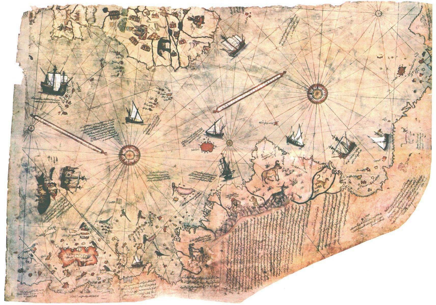
The map is said to be so precise that it included detailed drawings of Antarctica’s northern ridge – 300 years before the continent was officially discovered.
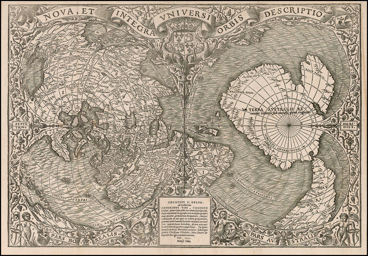
The Piri Reis is not the only map depicting Antarctica long before its official 1821 discovery. The Oronce Fine map published in 1531 includes it too. More intriguing still this map features rivers and lakes which satellite imaging confirms do exist.
But how could the cartographers know , if no one set foot there until the nineteenth century?
Well, according to Professor Charles Hapgood, the Antarctica was once home to an ancient civilization. Its citizens fled or perished when natural disasters transformed the continent into the 14 million square km of dangerous icy terrain that dominates the land today. So could the remains of this lost city still exist under the ice ?
Check out the video to find out more:
[shareaholic app=”share_buttons” id=”5111567″]